
Our new survey kit
- David Quick
- Jun 11, 2021
- 5 min read
Updated: Aug 21, 2021
One of the things that I have been impressed by with our group is the way we have kept up with new technology and used it to help us with our digs and explorations. For example, we use tools such as LIDAR, drones, aerial imagery, geophysics machines, GIS software and lots of other resources to help us research and visualise our sites and decide where best to dig. Then we use tools such as 3D imagery to show off our finds or dig sites. However, accurate surveying has always felt to me like it is still in the dark ages.

For a long time we have had to rely on tape measures, dumpy levels and staffs to set our our site grids and do the measurements of location and levels. In practice I have found that this led to some significant errors; when overlaying supposed trench positions onto drone photos of the same features I found some errors of as much a 1 metre.


More recently Carl Raven moved us a bit more into the 21st century when he purchased his own Total Station and later his EDM (electronic distance measuring) machine, which uses a laser to measure and considerably sped up setting out baselines for digs and geophys.
However, the lightbulb moment for me was when in December 2019 I went to give a talk to the members of Surrey Archaeology, where afterwards I met one of their members who was experimenting using GNSS (global navigation satellite system) to get centimetre-accuracy surveying using just a device on top of a pole. This fascinated me and I discovered that you could now measure the position and height of a feature to within 1cm using a small electronic device on top of a pole. What's more, the price of these devices had just plummeted because a new market entrant was selling the equipment for £4000 that a year previously would have typically cost £15-20,000. I realised how much time it could save us setting up our grids, measuring in trenches, doing levels and would be especially useful at places like Ludshott where members are trampling through the undergrowth under tree cover trying to get fixes on prehistoric and WW1/WW2 features.
To cut a long story short, our AGM approved a motion in April asking the Committee to consider a purchase and this was duly approved. Last weekend we took delivery and today three of us took the equipment into the field to test it, with impressive results. We ordered the more expensive Reach RS2 units because they lock onto the satellites immediately, give an instant fix on press of a button and work well under trees, unlike the cheaper version.
I'm not going to go into the geeky stuff here - you can look at the maker's website for a simple description of how it works - but our set-up looks like this:

What you see here is the 'base' unit on the tripod on the left, sitting over a precisely known mark on my garden patio. The first thing I did was get the 'base' unit to calculate very accurately its position and then I applied something called 'RINEX' corrections downloaded from the Ordnance Survey's station at Farnborough. This plot shows how accurate the fix was - look at the number of decimal places and the error:

Then I turned on the identical 'rover' unit that you can see to the right of the base unit, sitting on its own 2-metre high survey pole, and told the base unit at its fixed location to send corrections via a built-in LoRa radio to the 'rover'. So now as you move around with the 'rover' (keeping the pole vertical with a built-in spirit level) the 'rover' knows where it is to within a centimetre in position and 1.5cm in height. The two units can use the radio to communicate with each other up to 8km away. (You can even get them to communicate up to 50km away but you then need sim cards for each unit so they can talk to each other via Internet connection, and we don't want to incur the costs.)
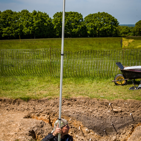
When we took the 'rover' out this morning we decided to test them on our exploration sites in Alton - the Public Gardens and the St Lawrence churchyard - which are about 1km away from my patio with lots of buildings in between and lots of trees. We started in the Gardens by taking fixes on the corners of the Town Council's marquee and of a climbing frame:

The unit incidentally uses as its display either an iPhone, iPad or Android device (and mine is fitted to the pole in a clamp). We then went up to St Lawrence Church and surveyed the corners of various gravestones:

The circles on the plot above show the corners of various tombs and gravestones. To make things more difficult Paul Kennedy (who most of you know is a professional surveyor) asked me to try to get fixes right up against the church wall (points 42 and 43) and against the gate in the perimeter wall (point 44). Despite the antenna being right against the walls, the units still managed to get a fix to our surprise, albeit with an error of up to 20cm for these points. The fix co-ordinates are incidentally downloadable in National Grid (OSGB36) format, so we don't need to convert them.
So what are the next steps? For equipment insurance reasons we are going to limit who can take the units home with them. I am suggesting to the Committee that sensible next steps would be:
Fieldwork Committee agree on a list of names of those members who need to be trained to use the machine and another list of those who need to be able to download the data and import it into our mapping software (called QGIS).
Me to organise a 'day school' to give the training.
Me to prepare some 'cheat sheets' or checklists to make sure users don't make any silly mistakes (like forgetting to enter the height of the survey pole or using the wrong co-ordinate system).
Accurately survey some fixed points at each of our main sites over which we can site the 'base' unit when working there, e.g. at Colemore, Stroud and Alton. For this purpose we have bought some permanent ground markers (big spikes 14" long by 1" diameter with barbs to make them difficult to remove). These do not necessarily have to be in the same place as our TBMs; in fact they would be better placed somewhere where it is easy to site the tripod over them and where they won't be disturbed by tractors or livestock - perhaps within the Colemore toilet enclosure for example. This is what they look like before being hammered into the ground:

Do let us have your questions!


Ready to get started? Log in to bankomat to instantly access our live inventory of bankomat CC numbers, SSNs, and other exclusive listings.
Welcome to StashPatrick – where the best of Patrick Market comes together. Your premium experience starts at patrickstashh.cc.
Patrickstash cc, commonly is a platform that has garnered considerable interest from both cybersecurity professionals and law enforcement organizations.
Patrickstash cc (often abbreviated as S0 or S0.cc) is one such platform that has attracted significant attention from cybersecurity experts and law enforcement agencies alike.